Permanent survey marks (PSMs), commonly known as survey marks, are a key component of South Australia’s surveying and spatial framework. They serve as valuable state infrastructure, underpinning the surveying of property boundaries, mapping, development and construction activities. Survey marks contain precise coordinate and height information, providing the stable geodetic reference frame that connects surveys and other spatial datasets.
The Survey Operations Unit maintain:
- South Australia’s network of permanent survey marks, offers reliable reference points for surveyors to determine property boundaries and establish positioning for construction, mining and mapping
- An enquiry system for survey mark information, including access to survey mark layers through the South Australian Property and Planning Atlas (SAPPA)
Importance of survey marks
Permanent survey marks support a wide range of activities across South Australia, including:
- Cadastral (land boundary) surveying and land administration
- Engineering and construction projects
- Roads, utilities and public infrastructure
- Mapping and spatial datasets
The ongoing availability and integrity of these marks is essential for maintaining accurate and reliable survey information.
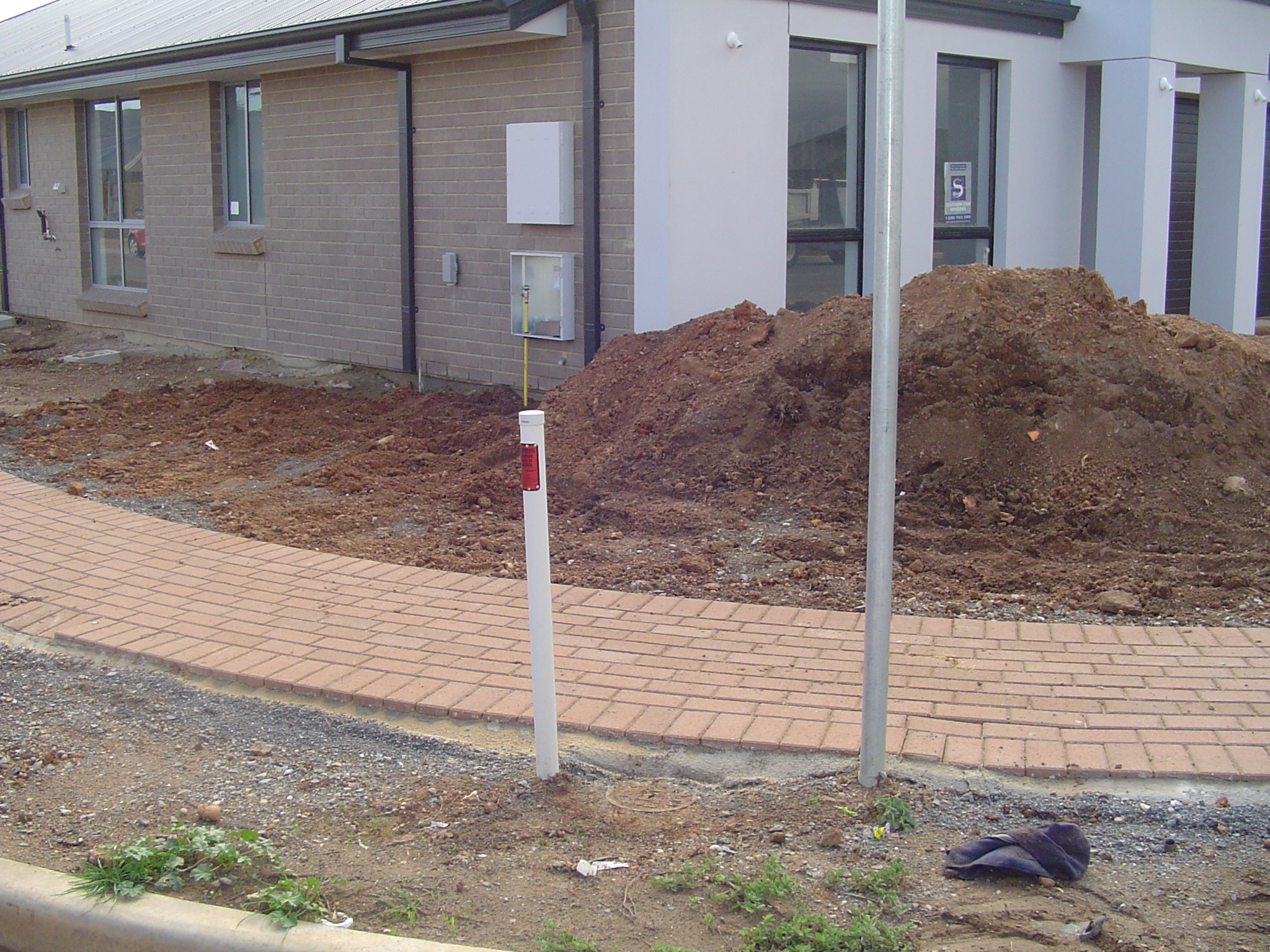
What do survey marks look like?
Permanent survey marks may appear in different forms, including:
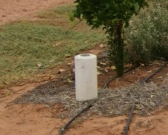
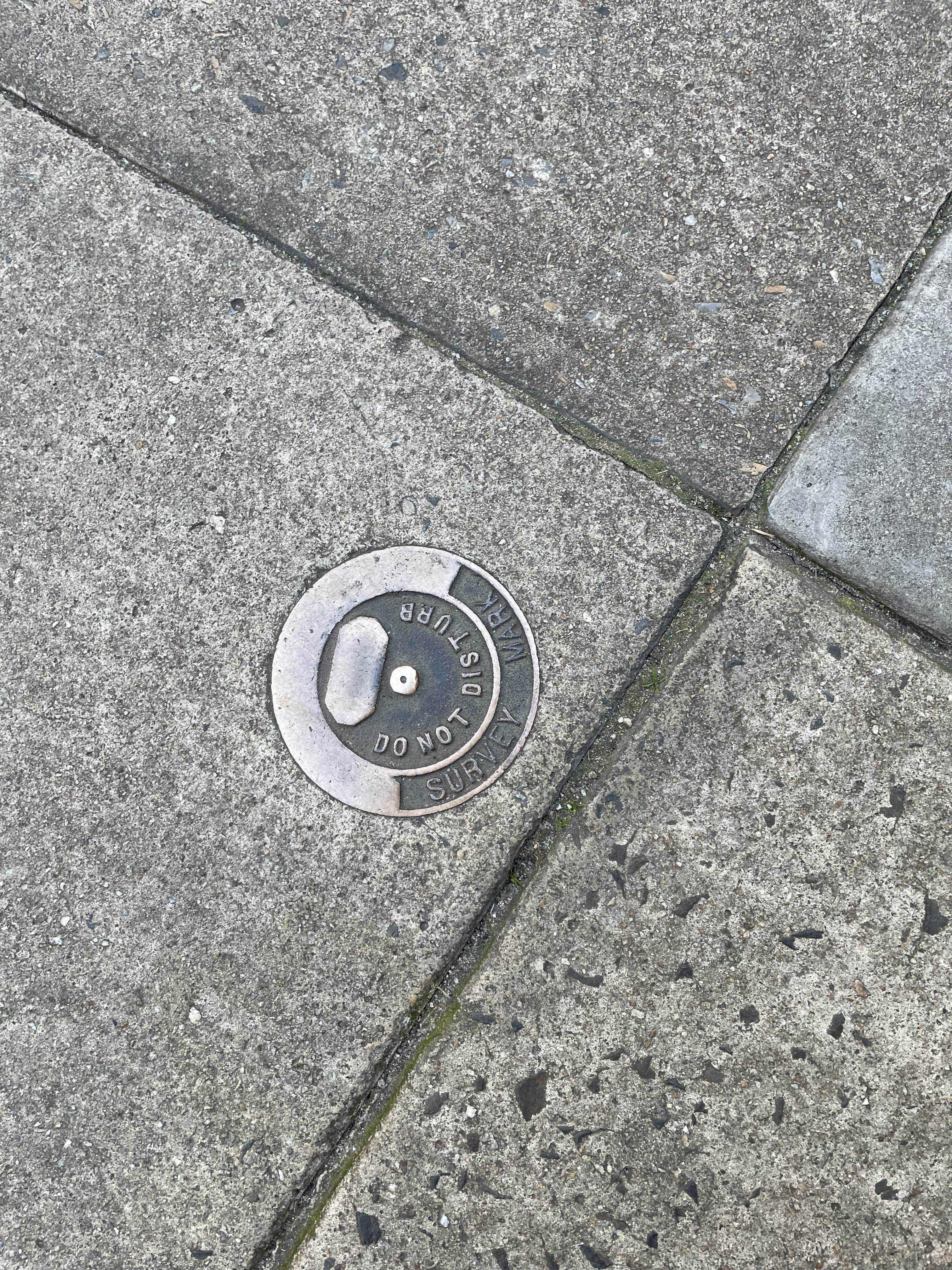
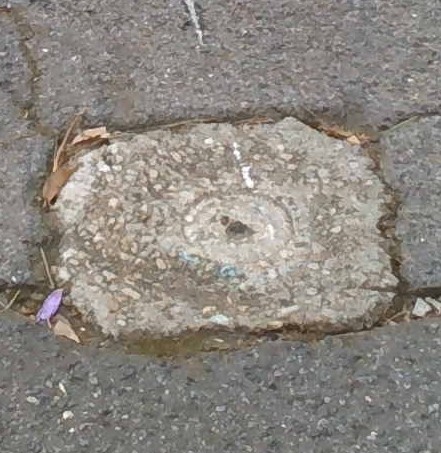
They are commonly located in road reserves, roadways, footpaths and other public areas, but may also be located on private land.
In many locations, survey marks are protected or indicated by witnessing, which helps people in identifying the presence of a survey mark. These witnessing features help protect survey marks and make them easier to locate, especially where the mark sits below ground level or could be obscured by machinery. Witnessing is not the survey mark itself, but can include:
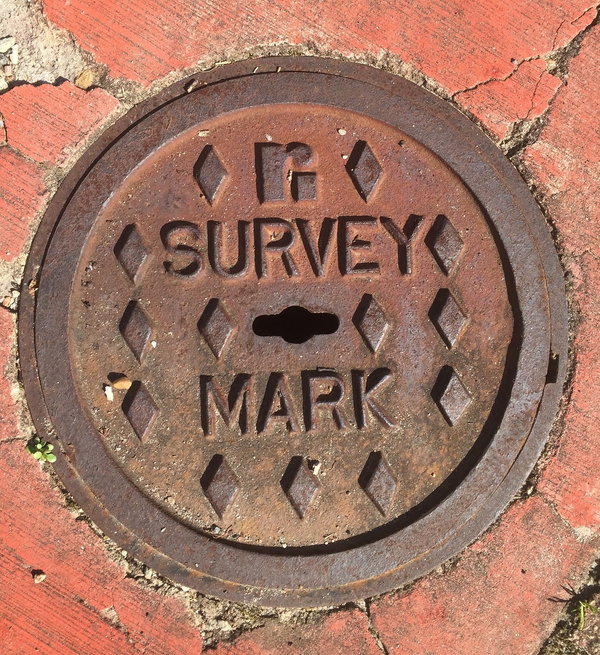
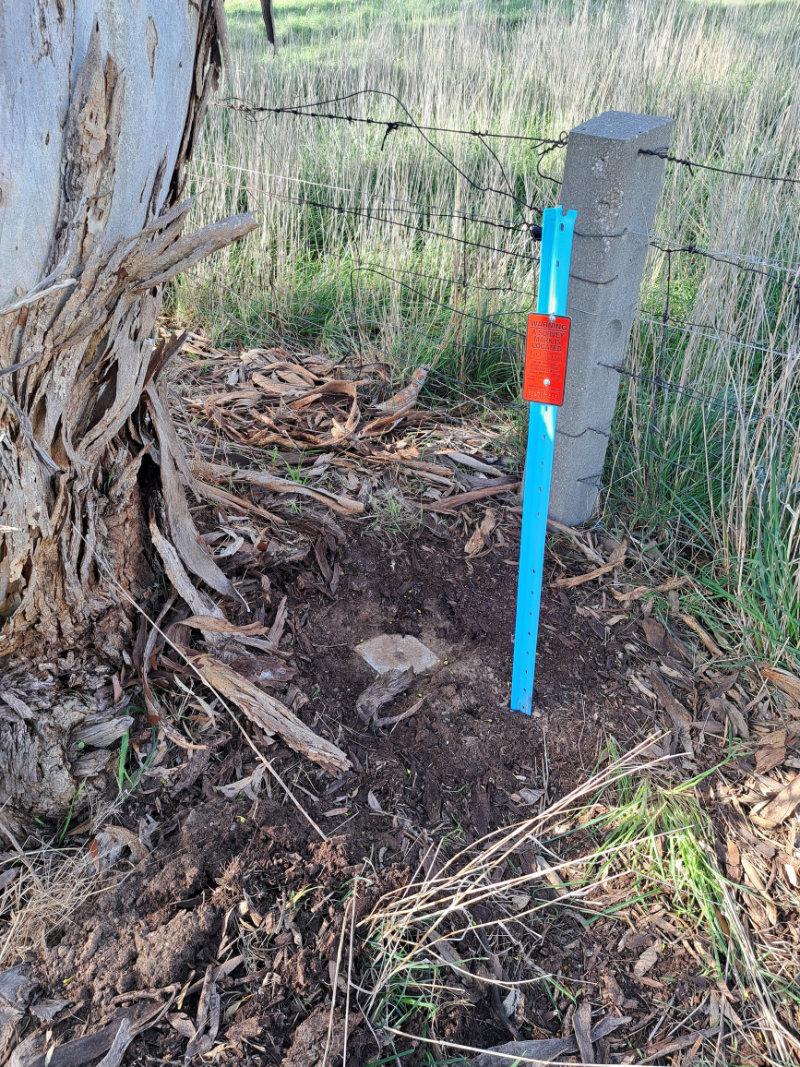
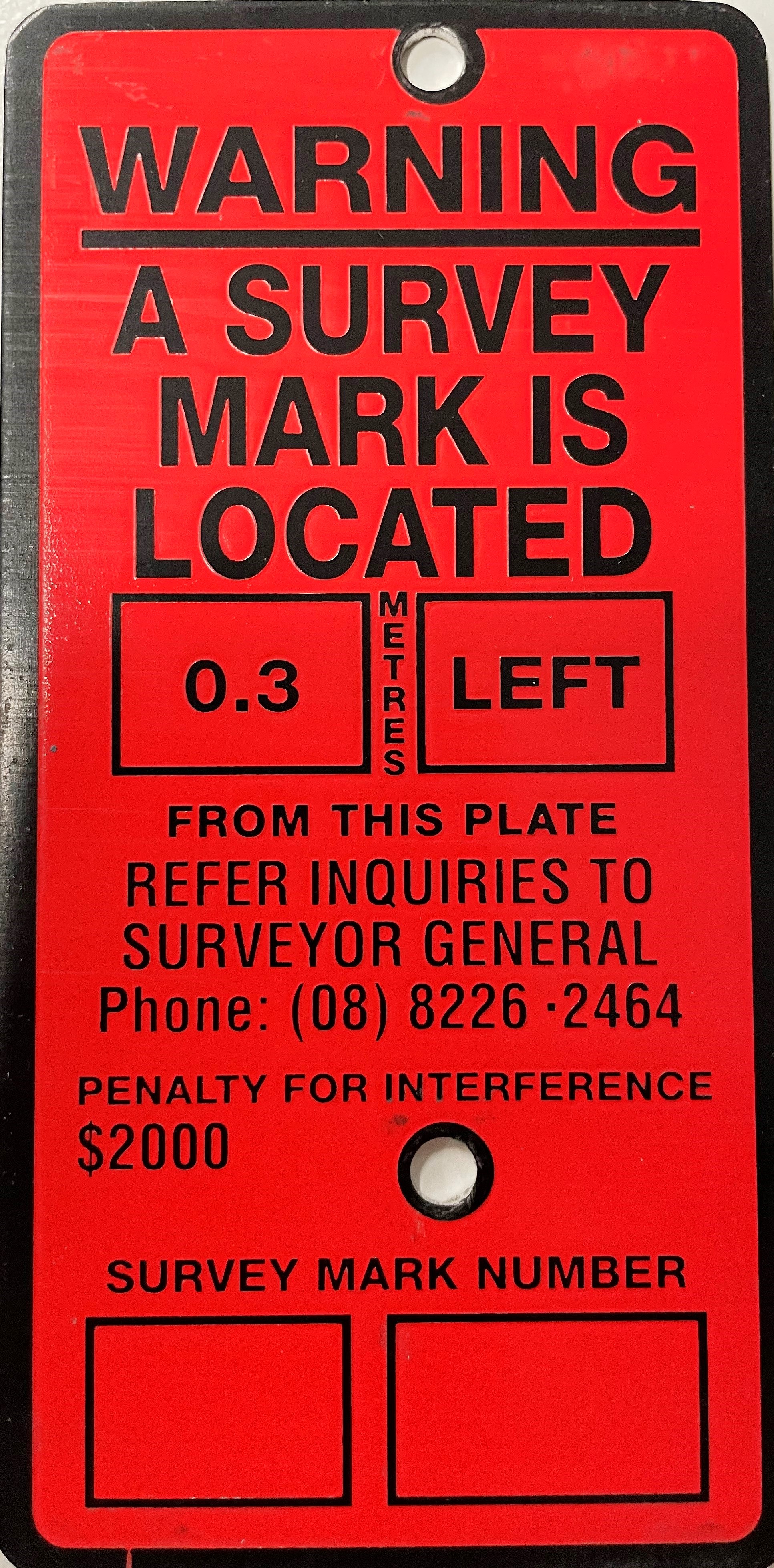
These witnessing features help protect survey marks and make them easier to locate, especially where the mark sits below ground level or could be obscured by machinery.
Learn more about
Resources
- SA Convention for the Australian Height Datum (AHD) Survey Control Network
- Historical MGA94 Coordinates (XLSX)
- Permanent Survey Marks FAQs
- PSM Gone Report Form (external site)
- South Australian Property and Planning Atlas (SAPPA) (external site)
Survey enquiries
For survey mark enquiries or EDM calibration bookings please contact:
Phone: (08) 7133 2300
Email: DHUD.SurveyOperations@sa.gov.au